Uganda's Mountains of the Moon
Rwenzori Mountains National Park
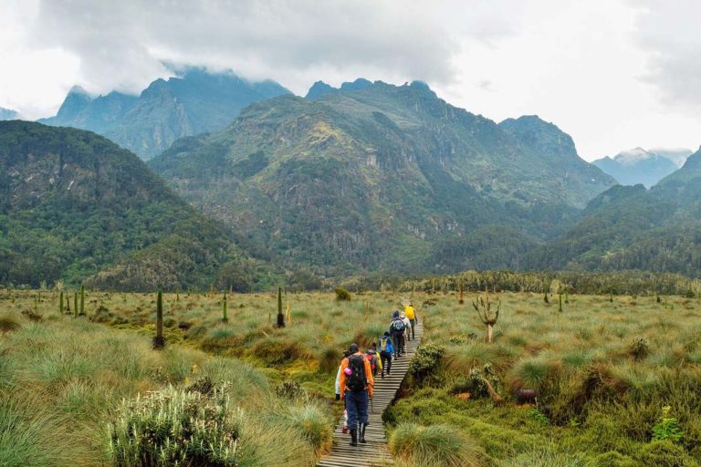
Rwenzori Mountains National Park is a 996 km² UNESCO World Heritage Site on Uganda’s western border with the DRC, protecting Africa’s third highest massif. Margherita Peak on Mount Stanley reaches 5,109m — one of only three glaciated mountain ranges remaining in Africa. The Rwenzoris offer trekking routes ranging from 2-day lower slope walks to the 9-day central circuit to Margherita Peak, through some of the most extraordinary mountain vegetation on the continent.
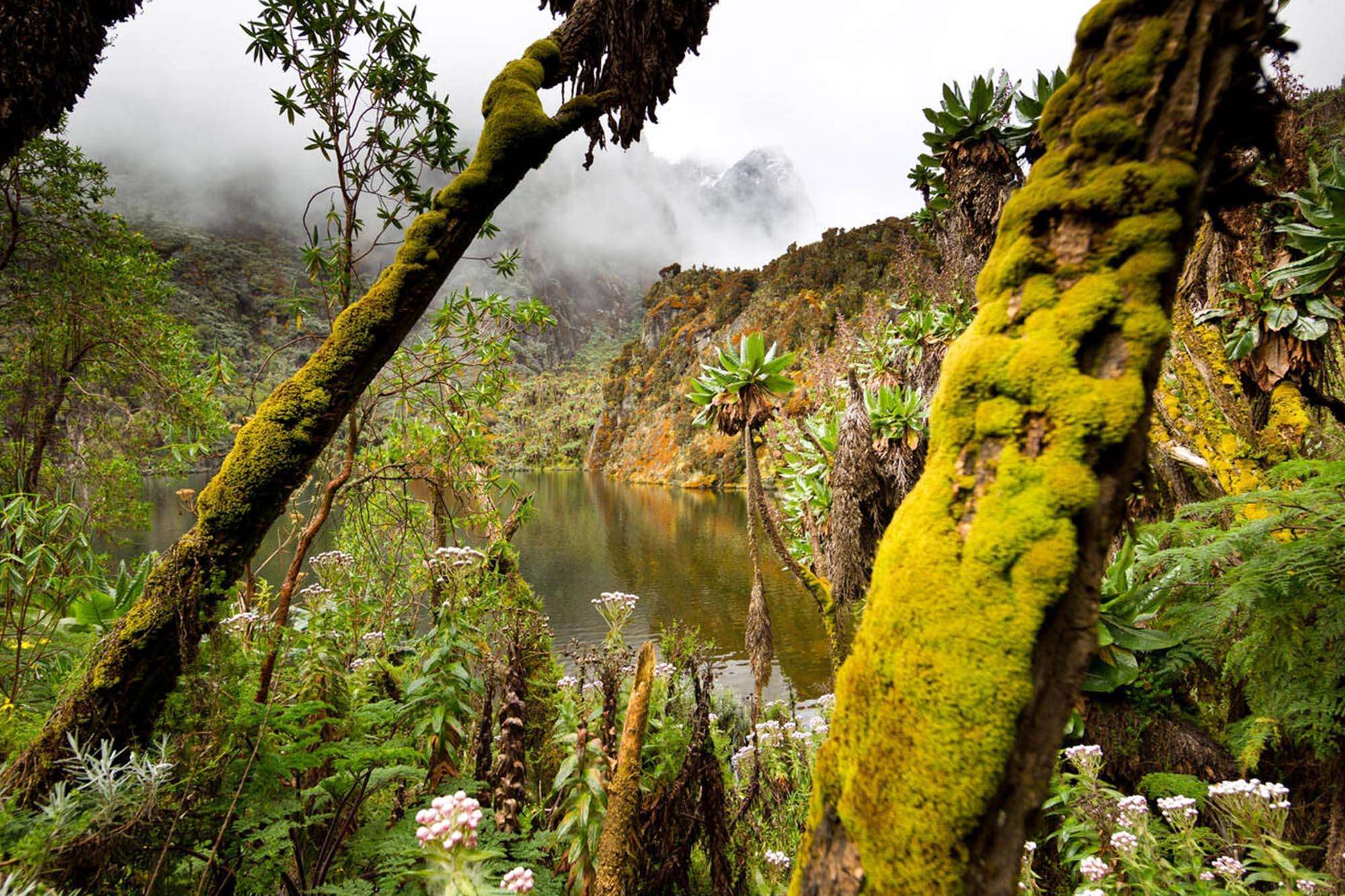
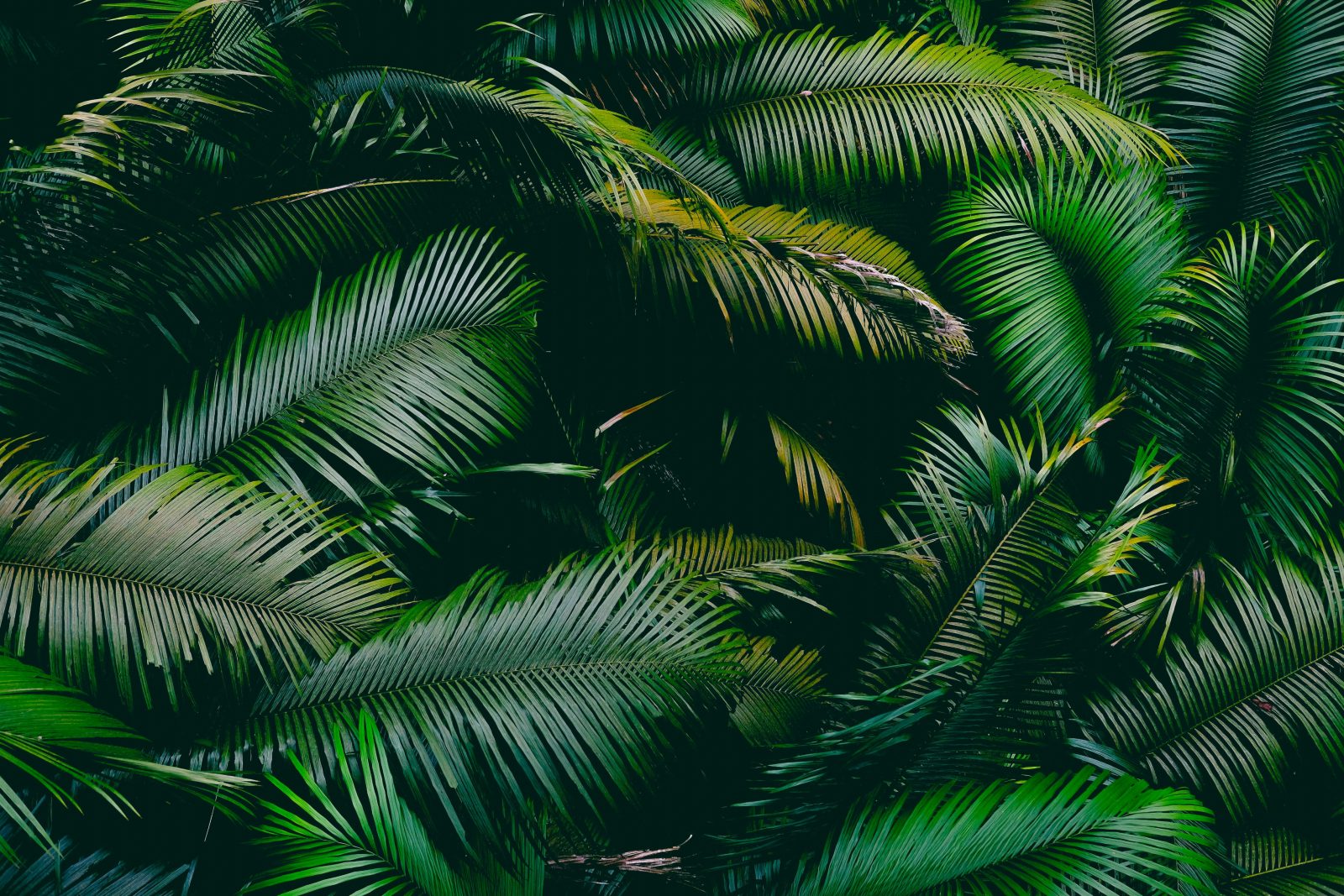
The Rwenzori Mountains are one of Africa’s most distinctive and least-visited high-altitude destinations. Their appeal is botanical as much as geological — the vegetation zones that change with altitude create an ecosystem unlike anything else on the continent, from dense montane rainforest at the base to giant lobelias, ten-metre heather trees, and alpine meadows surrounding glacial lakes at the summit zone.
The key facts:
- Africa’s third highest massif — Margherita Peak, 5,109m, on Mount Stanley
- One of three glaciated ranges in Africa — alongside Kilimanjaro and Kenya; glaciers are slowly retreating due to climate change
- 996 km² UNESCO World Heritage Site — gazetted 1991; also an Important Bird Area
- 217+ bird species including 17 Albertine Rift endemics — Rwenzori turaco, Rwenzori batis, double-collared sunbird
- Endemic wildlife — Rwenzori three-horned chameleon, Rwenzori colobus monkey, Rwenzori otter
The five vegetation zones on ascent:
- Montane rainforest (1,600–2,500m) — dense forest with colobus monkeys, birding, and Mubuku River
- Bamboo and tree heather (2,500–3,500m) — ten-metre Erica arborea, old man’s beard lichen
- Giant heather and lobelia moorland (3,500–4,000m) — giant senecios, everlasting flowers, glacial lakes
- Alpine desert (4,000–4,500m) — sparse vegetation, rock, and the first snow views
- Glaciers and summit (4,500–5,109m) — Margherita Peak; crampons and ice axes required
Trekking routes:
- Central Circuit to Margherita Peak — 9 days; the full high-altitude route through Bujuku Valley to Margherita; crampons and ice axes required; technical experience beneficial but guided ascent available for fit beginners
- Mahoma Trail / Lower Slopes — 2–5 days; accessible without technical gear; reaches up to 3,975m (Mutinda Lookout) or Lake Mahoma at 3,515m
- Weismann’s Peak — 5 days; 4,620m; no technical gear required
- Mount Baker Trek — 7 days; 4,842m; high altitude but non-glaciated summit
The Rwenzori Mountains receive rainfall year-round — they are genuinely one of Africa’s wettest ranges and wet, muddy conditions should be expected in every season. The two dry windows give the most reliable summit visibility and the most manageable trail conditions.
Dry seasons — December to February and June to August — are the recommended windows. Trails are less slippery, summit views are clearest, and the glaciers are most safely approached. Even in the dry season, rain and cloud are possible above 3,000m.
Wet seasons — March to May and September to November — bring heavier rainfall, significantly muddier trails, and reduced summit visibility. Lower slope walks remain feasible in these windows but the central circuit to Margherita Peak is harder and success rates on the summit are lower.
The first and generally most reliable dry window. Clear skies are more common, summit visibility is at its best, and trail conditions are most manageable. A good window for both the central circuit and lower slope walks. The Christmas and New Year period sees higher demand — book guides and permits in advance.
The second dry season. Conditions are similar to December–February, with manageable trails and reliable summit visibility. The main dry season for Uganda’s western safari circuit — combining the Rwenzoris with Queen Elizabeth National Park or Kibale Forest is natural in this window
Wet seasons. Heavier rainfall makes trails slippery, particularly on steeper sections of the central circuit. The lower slope walks (Mahoma Trail, 2–3 day routes) remain feasible but demand good waterproofs and gaiters. Summit conditions on Margherita are less reliable. Best avoided for a first Rwenzori visit unless lower-slope objectives only.
Getting here: The Rwenzori trailhead is at Nyakalengija village near Kasese town in western Uganda. Kasese is approximately 6–8 hours by road from Entebbe/Kampala. Domestic flights from Entebbe to Kasese Airstrip take approximately 30–45 minutes — available through scheduled operators; confirm availability at booking. The Rwenzoris are close to Queen Elizabeth National Park — a 2–3 night QENP extension before or after the trek is the most natural combination.
Permits and fees (foreign non-residents):
- Park entrance: $35 per person
- Trekking permit: $50 per person
- All trekking must be done with a registered Rwenzori Mountaineering Services (RMS) guide
- Porters are available for hire at the trailhead — strongly recommended; their fee supports the local Bakonzo community
- Central circuit (Margherita): crampons, ropes, and ice axes required for the final ascent — supplied by RMS
Mountain huts on the central circuit: Sine Hut (2,596m) → Kalalama Camp (3,134m) → Samilira Camp (3,170m) → Kiharo Camp (3,460m) → Mutinda Camp (3,588m) → Butawu/Hunwick’s Camp (3,974m) → Bugata Camp (4,062m) → Margherita Camp (4,485m)
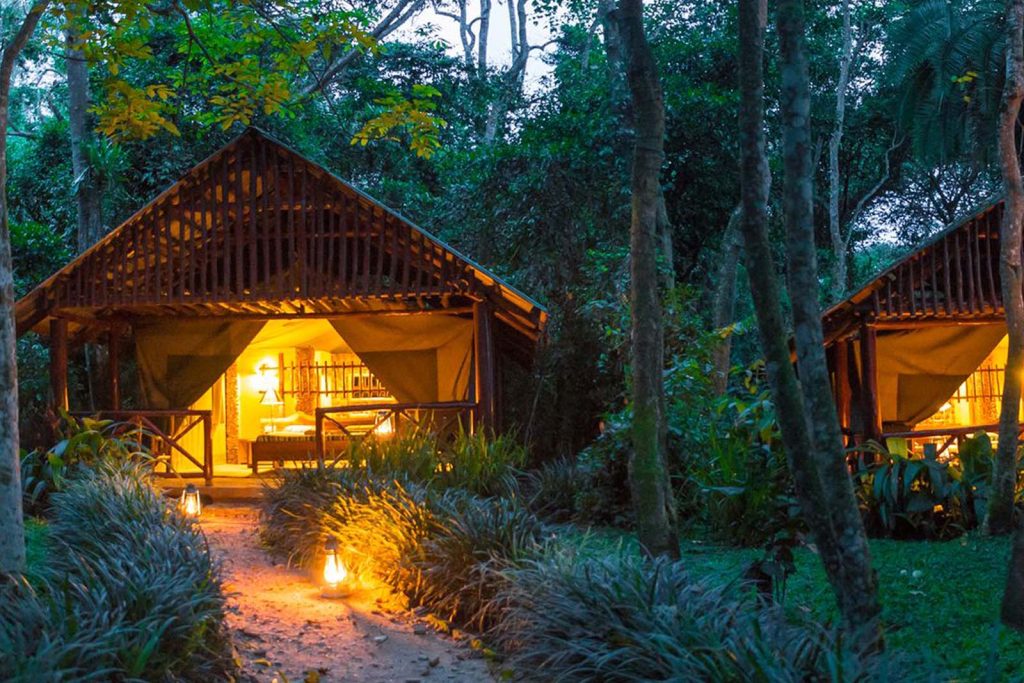
Base accommodation near the park:
- Ruboni Community Camp — near the Nyakalengija trailhead; community-run by the Bakonzo; traditional cultural experiences including dance; recommended pre/post-trek base
- Equator Snow Lodge — near the park entrance; comfortable rooms; outdoor activities
- Rwenzori Trekkers Hostel (Kyanjuki village) — basic but popular with climbers; camping, dorms, and private rooms
Health and practical: Good cardiovascular fitness and prior hiking experience are required for any Rwenzori route above the lower slopes. Altitude sickness risk increases above 3,000m — ascend slowly, stay hydrated, and communicate symptoms immediately to your guide. Waterproof boots, gaiters, warm sleeping bag (−5°C minimum), rain jacket, and trekking poles are essential for all routes. Soft-sided bags are required for porters. Yellow fever vaccination required for Uganda entry; anti-malarial prophylaxis recommended.


5-Day Rwenzori Mountains Lower Slopes Trek — The Mahoma Trail

9-Day Rwenzori Mountains Hiking Safari — Margherita Peak (5,109m)
Some of Our
Frequently Asked Questions
Crampons, ice axes, and ropes are required for the final section of the Margherita Peak ascent — the glaciated terrain above Margherita Camp (4,485m). Prior mountaineering experience is beneficial but not strictly required — the RMS guides are skilled professionals who lead fit beginners through the technical section successfully. Good physical fitness, mental resilience, and a minimum of 7 days on the mountain for acclimatisation are the non-negotiables. The lower routes (Mahoma Trail, Weismann’s Peak, Mount Baker) require no technical gear.
Both are high-altitude African mountain experiences but they are very different in character. Kilimanjaro is a walk-up volcano on open moorland — the challenge is altitude, not terrain. The Rwenzoris are technically more demanding (glaciated summit, steeper trails, denser vegetation) and significantly wetter. The Rwenzoris’ botanical character — giant lobelias, ten-metre tree heathers, mossy forests — is unlike anything on Kilimanjaro. Kilimanjaro receives approximately 50,000 climbers per year; the Rwenzoris receive a fraction of that number. Serious trekkers who have done Kilimanjaro typically describe the Rwenzoris as the more remote, more challenging, and more rewarding experience.
The Mahoma Trail is a 2–5 day lower slopes route that reaches up to 3,975m (Mutinda Lookout) or Lake Mahoma at 3,515m without requiring crampons or ice axes. It passes through montane forest, bamboo, and giant heather zones — giving a genuine Rwenzori botanical experience without the technical demands of Margherita. It is suitable for experienced hikers with good fitness and comfort in wet, steep forest conditions. Waterproof boots, gaiters, and a rain jacket are essential.
The Nyakalengija trailhead near Kasese is approximately 6–8 hours by road from Entebbe. Domestic flights from Entebbe to Kasese Airstrip reduce the journey to approximately 30–45 minutes. Queen Elizabeth National Park is approximately 2–3 hours from Kasese — the Rwenzoris sit on the park’s western boundary, making a Rwenzori trek and QENP game drives a highly practical combination in a single western Uganda trip.
December to February and June to August are the two dry seasons and the recommended windows. Trails are most manageable, summit visibility is clearest, and the technical Margherita section is safest in dry conditions. The Rwenzoris receive rainfall year-round — wet conditions should be expected even in the dry season at altitude. The wet seasons (March–May and September–November) are feasible for lower slope walks but not recommended for first-time Margherita attempts.
Yes — the Rwenzoris, Bwindi Impenetrable Forest, and Queen Elizabeth National Park form a natural western Uganda circuit. A typical combination adds 5–9 days of Rwenzori trekking (lower slopes or central circuit) to the standard gorilla and game viewing circuit. After your trek, the contrast of standing face to face with a mountain gorilla in Bwindi’s forest — an entirely different kind of mountain experience — is consistently described as one of Uganda’s most memorable combinations.
Testimonials
